
| | Institute of Computer Science — Knowledge-Based Systems Research Group |
Kurt3D at ELROB 2006 |
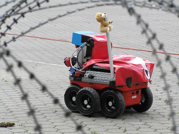
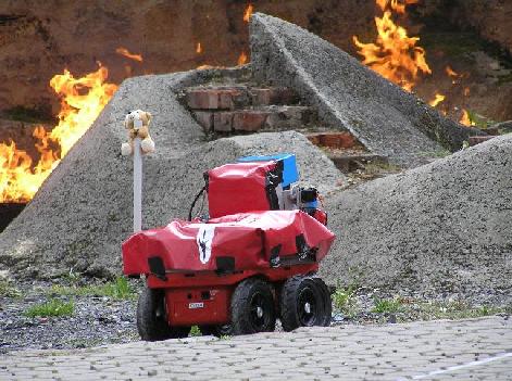
Figure: Kurt3D is a (semi autonomous) mobile robot for site surveillance and urban search and rescue. Kurt3D did participate in the urban part of the ELROB trial. The robot has excellent 3D mapping capabilities using its 6D SLAM (simultaneous localization and mapping) algorithms. The 3D maps are particularly useful for situation awareness.
Our Kurt3D is a modified version of a standard KURT2 [1]. It is the prototype of a wireless autonomous mobile robot, with a size of 45 cm (length) x 44 cm (width) x 60 cm (height) and a weight of 25 kg. It is equipped with a Panasonic tough-book (1.40 GHz Pentium 4) and a 3D laser range finder (based on a Sick LMS). Kurt3D operates for about 4 hours with one battery charge (28 NiMH cells, capacity: 4500 mAh).
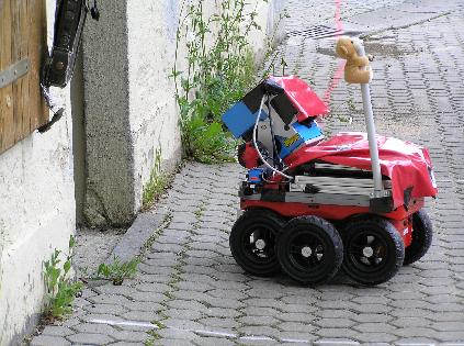
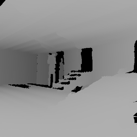
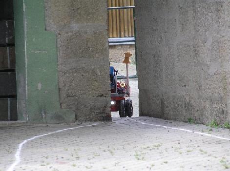
Kurt3D scanning a building by its tilting 3D laser range finder. The ELROB operator of Kurt3D decided to map one building of the urban environment. The building was entered and several 3D laser range scans have been matched to create a precise 3D model. The following figures show some results of the mapping process. The first image is a rendering from inside the building.
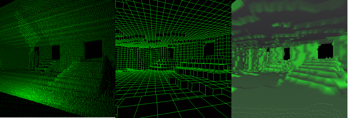
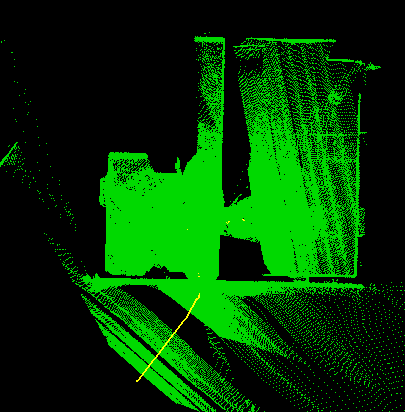
The next results show the point cloud (left), the octree cubes (middle) and the marching cubes (right, with lighting). All these results are immediately available to the operator of the robot and can be used for precise navigation and obstacle avoidance. A-priori knowledge of the site is unnecessary for the operation of Kurt3D.
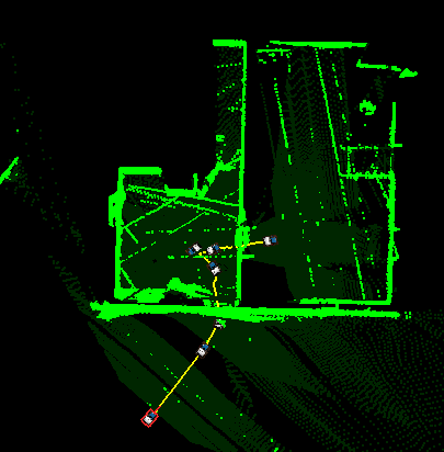
After acquiring and automatically registering several scans, the operator gains a precise 3D map of the building. The following figures show the map in a bird eye's view, with the trajectory and robot's poses plotted. Left: All points are shown. Right: Same map as floor plan.
As you may see on the photos, all participants saw the course beforehand and were able to take some measurements (which several of them did / had to do).
Photos of the day can be found here.The terrain includes urban obstacles like cars, stairs, narrow passes, and collapsed ceilings. The task is to search for and identify objects located around and inside buildings. The maximum distance for the urban scenario is approximately 500 meters.
Due to its size and limited mobility, Kurt3D did not participate in the non-urban trial.
The terrain contains both paved and unpaved roads as well as ditches, fences and fire. Both natural objects like trees and stones, as well as artificially placed objects may block the path and have to be circumnavigated. The task is to follow a predefined route and to locate targets at certain points of interest. The maximum distance for the non-urban scenario is approximately 2000 meters.
Photos of the day can be found here.Andreas Nüchter, Kai Lingemann, and Joachim Hertzberg. Kurt3D -- A Mobile Robot for 3D Mapping of Environments, ELROB Technical Paper, Hammelburg, Germany, May 2006. [Get Technical Paper (PDF)] [Get Team Information (PDF)] [Get Vehicle Specification Sheet (PDF)] [Get Team Roster (PDF)].
![]() Abstract: The mobile robot Kurt3D
is the first robot that is capable of mapping its environment in 3D
and self localize in all six degrees of freedom, i.e., considering its
x, y and z positions and the roll, yaw and pitch angles. Robot
motion on natural surfaces has to cope with yaw, pitch and roll
angles, turning pose estimation into a problem in six mathematical
dimensions. Kurt3D creates a consistent volumetric scene in a common
coordinate frame from multiple 3D laser scans. To create 3D volumetric
maps it is necessary to gage several 3D scans and register them into
one consistent 3D model. A fast variant of the Iterative Closest
Points (ICP) algorithm is used for registration and relocalization.
Abstract: The mobile robot Kurt3D
is the first robot that is capable of mapping its environment in 3D
and self localize in all six degrees of freedom, i.e., considering its
x, y and z positions and the roll, yaw and pitch angles. Robot
motion on natural surfaces has to cope with yaw, pitch and roll
angles, turning pose estimation into a problem in six mathematical
dimensions. Kurt3D creates a consistent volumetric scene in a common
coordinate frame from multiple 3D laser scans. To create 3D volumetric
maps it is necessary to gage several 3D scans and register them into
one consistent 3D model. A fast variant of the Iterative Closest
Points (ICP) algorithm is used for registration and relocalization.
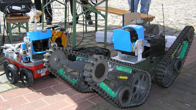
Figure: Kurt3D and Telemax. Fraunhofer AIS let run Andreas' 6D SLAM algorithms on the Telemax robot, that is produced by Telerob.
If you have any questions about the current state of Kurt3D and its software please contact:
Andreas Nüchter